Analemmatic Sundial
There are many internet webpages that show us how to build an horizontal analemmatic sundial.
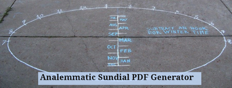
We are now referring to a one of the best places : Analemmatic Sundial PDF Generator. In this page you will find all the things you need to make your own horizontal analemmatic sundial.
We are now referring to a one of the best places : Analemmatic Sundial PDF Generator. In this page you will find all the things you need to make your own horizontal analemmatic sundial.
To handicraft an analemmatic sundial we need to know several parameters:
In the first place we have to know which are our geographic coordinates (latitude and length) since depending of the same the design of the sundial goes to vary.
There are several internet pages where we can consult these data. For example :
In the first place we have to know which are our geographic coordinates (latitude and length) since depending of the same the design of the sundial goes to vary.
There are several internet pages where we can consult these data. For example :
- Determine your Lat/Lon [http://science-edu.larc.nasa.gov/scool/latlong.php]
- Latitude/Longitude Finder [http://mynasadata.larc.nasa.gov/latitudelongitude-finder/]
- Calcular distancias, orto y ocaso, latitud y longitud [http://perso.wanadoo.es/juckar/]
- Latitude and Longitude [http://www-istp.gsfc.nasa.gov/stargaze/slatlong.htm]
- Tools for consumers and designers of solar energy : Collection of tools to know and work with solar energy. Calculation of sun position, latitude longitude coordinates, photovoltaic systems, emissions CO2. [http://www.sunearthtools.com/dp/tools/pos_sun.php?lang=en]
In addition to knowing with accuracy which are our coordinates (Latitude – Longitude) we have to know also which is the North – South direction of the place of observation (meridian of the place), since this goes to condition the orientation of the clock and his good or poor accuracy.
This direction can obtain of diverse forms, from the traditional method assigned to Vitrubio (http://en.wikipedia.org/wiki/vitruvius) until others more modern methods that include the mathematical calculation like fundamental tool.
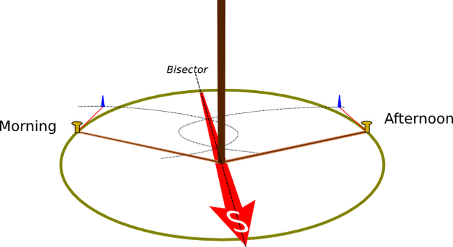
It exists a simple procedure to determine the north geographic pole in the sunny days, whose principle was billed by the architect and Roman engineer Marco Vitrubio Polión (c. 70 to.C.-c. 25 to.C.): It suffices to nail a stick, verify his perpendicularity (by means of a plummet) and mark in the morning a point that coincide with the extreme of the shadow that project the stick. With a rope we traced a circumference with centre in the stick and with a radius from this until the marked point. Afterwards we have to wait that in the afternoon the shadow of the stick go back to coincide with some point of the circumference. Then we must to trace the bisectrix (bisector) from the marked points to define the north geographic pole.
This direction can obtain of diverse forms, from the traditional method assigned to Vitrubio (http://en.wikipedia.org/wiki/vitruvius) until others more modern methods that include the mathematical calculation like fundamental tool.
It exists a simple procedure to determine the north geographic pole in the sunny days, whose principle was billed by the architect and Roman engineer Marco Vitrubio Polión (c. 70 to.C.-c. 25 to.C.): It suffices to nail a stick, verify his perpendicularity (by means of a plummet) and mark in the morning a point that coincide with the extreme of the shadow that project the stick. With a rope we traced a circumference with centre in the stick and with a radius from this until the marked point. Afterwards we have to wait that in the afternoon the shadow of the stick go back to coincide with some point of the circumference. Then we must to trace the bisectrix (bisector) from the marked points to define the north geographic pole.
|
But in our case we will use some computer tools that already will give us all the work done :
|

|
|
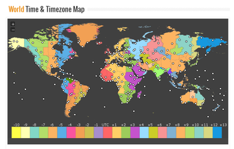
To use with accuracy these tools we have to know also which is our local time zone, including the possible time corrections by change of station (including daylight savings time / summer time).
We can visit some webpages related to this item :
|
|
|
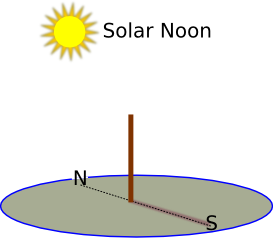
Once that we know at which hour the solar noon will become and before this moment, we will place a vertical stick in the place where we want to trace the analemmatic sundial. We have to ensure that the stick is perfectly vertical and that it does not tile to any side. When it arrives the moment of the solar noon we must to mark the shadow produced by the stick, which will indicate us, with all accuracy, which is the North – South line (the extreme of the shadow of the stick indicates the North and the base of the same the South). |
|
|
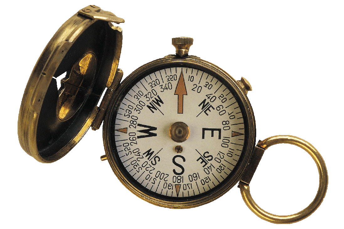
Another alternative method to know where is the North – South line would be employing a compass. In any case it is necessary to take into account that the Geographic North and the Magnetic North do not coincide, varying of different way of a place to another; it is necessary to know this fact.If we want to use the compass for this we have to apply the corresponding corrections, visiting, for example, the following pages :
|
Once collected the data of Latitude and Longitude and knowing which is exactly the North-South direction, we must to visit the page of internet that directly goes to design the sundial for us :
- Analemmatic Sundial PDF Generator [ http://analemmatic.sourceforge.net/cgi-bin/sundial.pl ]
It Is necessary to realize that in the realisation of the clock we have to be the most precise possible, referring to orient correctly the sundial and taking into account the possible irregularities of the terrain. The idea is try to do the clock to the perfection so that, at least, it will go out more or less well crafted !!.
